Free shipping in Canada for purchases over $150
Your cart is currently empty
Product image slideshow Items
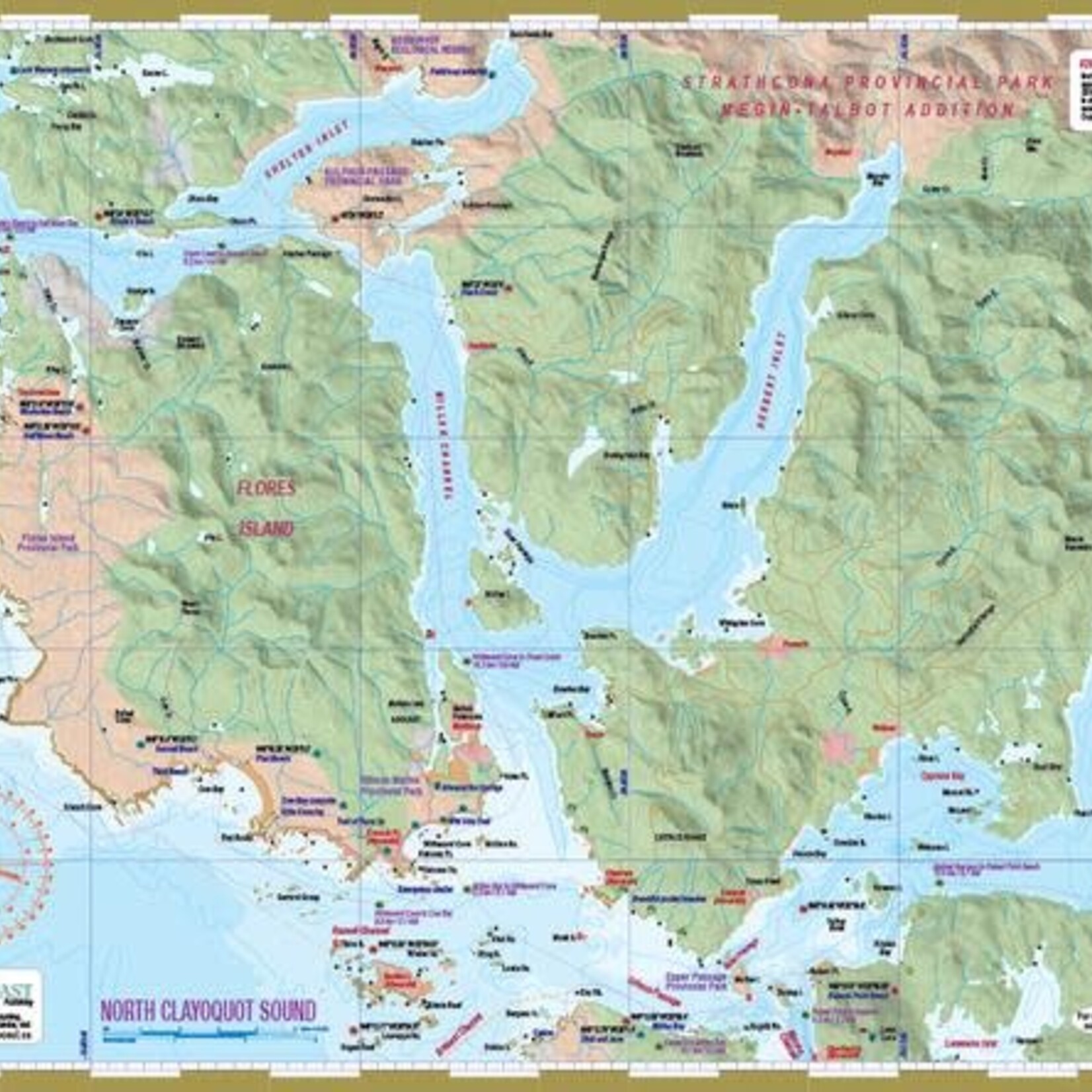
Waterproof kayaking and boating map.
Every purchase helps support the operating costs of our not-for-profit Tourism Tofino Visitor Centre. Take home a treasure for your soul and leave an invaluable contribution for ours.
The mapsheet is created by Wild Coast Publishing using some of the latest technology available to provide a high-quality printed image on waterproof/durable synthetic polymer stock. The stock is picked as the best for the purpose, and is significantly thicker than most papers at 10 mil weight.
This mapsheet packages the northern waters of Clayoquot Sound including the northern limits of Vargas and Meares islands (to mesh and slightly overlap with mapsheet #208), all of Flores Island, the major waterways of the area (Shelter Inlet, Herbert Inlet, Maurus Passage and Bedwell Sound) and Hot Springs Cove. Those starting from Tofino will want to have mapsheet #208 as well, and mapsheet #206 Hesquiat Peninsula for those continuing west and north of Hot Springs Cove.